One of the GIS applications on natural resources and the environment is to determine optimal locations for dumping sites by weighting an area by considering several factors such as the location distance from the river, elevation, soil type, distance from settlements, and others.
What is The Issue?
A dumping site is an excavated piece of land used as temporary storage for waste materials. Waste is a major problem in most places in Indonesia. The problem which often raises is the difficulty to find the land for the dumping site.
Why Dumping Site?
- Based on Google Trends, Topic for Garbage is one of the most searched topic in Google which relevant with Dumping Site, and searched by many people in different provinces in Indonesia.


- Also, I do social media trend analysis. I find out that some topic of Garbage is actually have a lot of views on Tiktok. For #garbage the views are 577.5M. It means that there are so many people that has aware with this issue.

Based on Google Trends and some Social Media Trend Analysis, we can conclude that Garbage is actually a popular topics and it h. This is why I choose Dumping Site for the topic in this project.
Why should be in Kulon Progo?
Based on my research, the potential for dumping site in Kulon Progo with a population of 434,483 people is estimated to be up to 173 tons per day or 63,260 tons per year. Meanwhile, the waste handled at the Banyuroto TPA in Kulon Progo is currently based on weighing data as much as 24-35 tons per day.
Reporting from harianmerapi.com (October 2021), "The condition of the Banyuroto TPA as of September 2021 has occurred. The location is indeed far from settlements and not densely populated. But if in the future the population is increasingly dense and around the TPA has become urban, this will become serious problem."
This is why I choose Kulonprogo to be the area of site selection.
Methodology

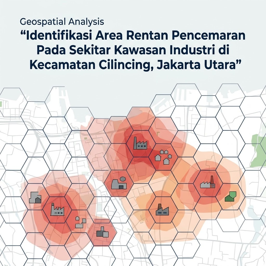
Buffer & Tessellation
The data used in this project are roads, city, land use, settlements, and rivers. The weighting for each input variable is based on the table 1 (Buffer zone layer with sub-criteria ratings). I use generate tessellation tool for producing the tessellation in hexagon shapes from the weighting result which have been done before in each variable. Analysis using vector approach with generate tessellation tools is available in ArcGIS Pro. The map result can be seen in the All Layer Maps section in GEO MAPID. The steps of generate tessellation are based on literature (Alkaradaghi et al. 2019).


Results


As shown in the image above (Figure 5 & 6), each hexagon has its values based on the weighting results and Total_Value calculations done previously. The higher the Total_Value, the redder the color will appear. The redder the color, the more it shows that the area in the hexagon area is less suitable for use as a dumping site area. On the other hand, the lower the value, which is indicated by a more
Conclusion
From this project, we can conclude some points, such as :
1. Waste is a major problem in most places in Indonesia. The problem which often raises is the difficulty to find the land for the dumping site.
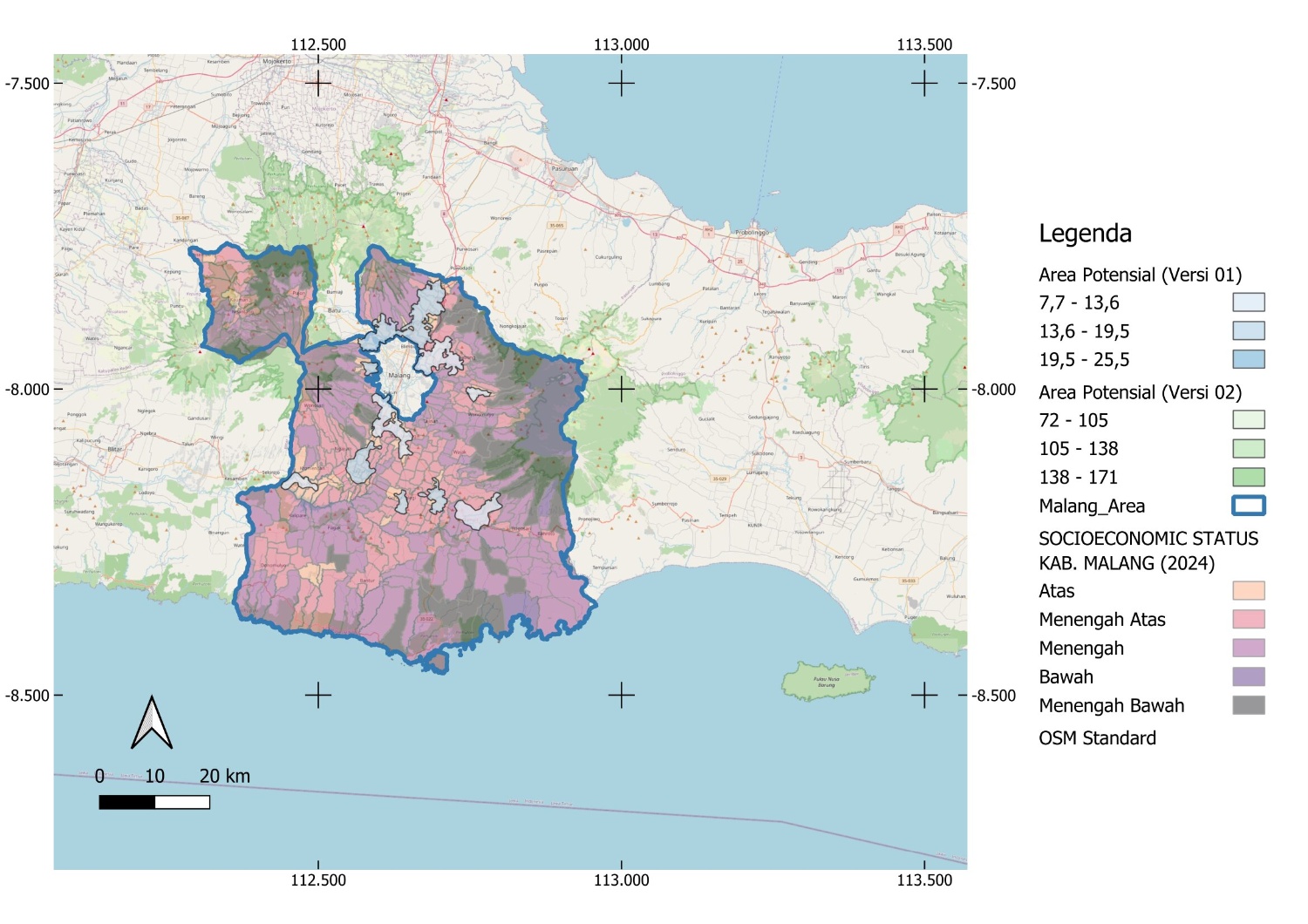
2. The project uses five polygon layers to find the best location for the dumping site in Kulon Progo with Generate Tessellation tools. The best site locations from Analysis result are in near Jalan tambon, Jalan gadingan Kulon Progo.
3. The project also provides a Dashboard to see the Opportunity of Site Location and Map Viewer by Geomapid to see all variable layers in one map.
References
Alkaradaghi K, Ali SS, Al-Ansari N, Laue J, Chabuk A. 2019. Landfill Site Selection Using MCDM Methods and GIS in the Sulaimaniyah Governorate, Iraq. Sustainability Journal. Accessible on: https://www.mdpi.com/2071-1050/11/17/4530.

![[GEODATA] Tutupan Lahan Indonesia](https://mapidstorage.s3.amazonaws.com/general_image/mapidseeit/1684312961161_COVER%20GEODATA_%20Tutupan%20Lahan.png)
![[GEODATA] Status Ekonomi dan Sosial (SES) Indonesia](https://mapidstorage.s3.amazonaws.com/general_image/mapidseeit/1693454652933_20230831-085941.jpg.jpeg)
![[GEODATA] Point of Interest (POI)](https://mapidstorage.s3-ap-southeast-1.amazonaws.com/foto_doc/mapidseeit/doc_1648452337_d8074cde-5aef-4820-88ba-b6cc500a7e04.jpeg)